Iain Crawford's paper " Contributions to a history of domestic settlement in North Uist" tried to identify the various settlements of North Uist. A few remained unidentified and the last post tried to address those missing identifications with the exception of Watna/Vannt.
Vannt/Watna
Watna 1505 RMS: ”Le Terung de Watna, Scolping et Gremynis”
Vannt 1718 Rental: between Trumiskarry and Hosta
Beveridge writes “it would almost seem that Vannt ought to be treated as a variation of the place-name Watna” and Crawford follows this principle.
In the 1505 rental, the order makes sense, following around the coast in a clockwise sense reading Bailrannald, Holf, “Watna, Scoping et Gremynis”, Wala then Solos. As Wala (Vallay) and Solos (Sollas) are included in the same charter then they are different places.
You would expect Watna as the first named to be logically geographically before Scolping then Gremynis in the clockwise round of North Uist
Beveridge argues that with Scolpaig as a 2d land and Griminish as a 4d land then Watna must be worth 14d to make up the terung and so is of quite a large extent, probably around 280ha of arable land.
Beveridge argues that Holf is Hougarry which leaves Watna to include some or all of Tigharry, Hosta, Balmartin and Balelone. However if Vannt is identified with Watna then in the 1718 rental, Hosta, Balloan, Tigheary, Kilpheder, Ballekinloch are all tenanted and so the only area left for Watna must be Balmartin. The problem is that Balmartin appears as Talmertane in the same 1505 charter as Watna with a 2d valuation providing a quandry, both in terms of size and of replication..
The only sensible conclusion is that Vannt and Watna are not the same place, contrary to the thoughts of Beveridge and Crawford.
Vannt must be an old name for Balmartin and there is some evidence for this discussed later.
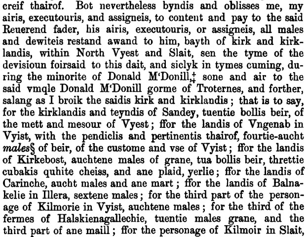
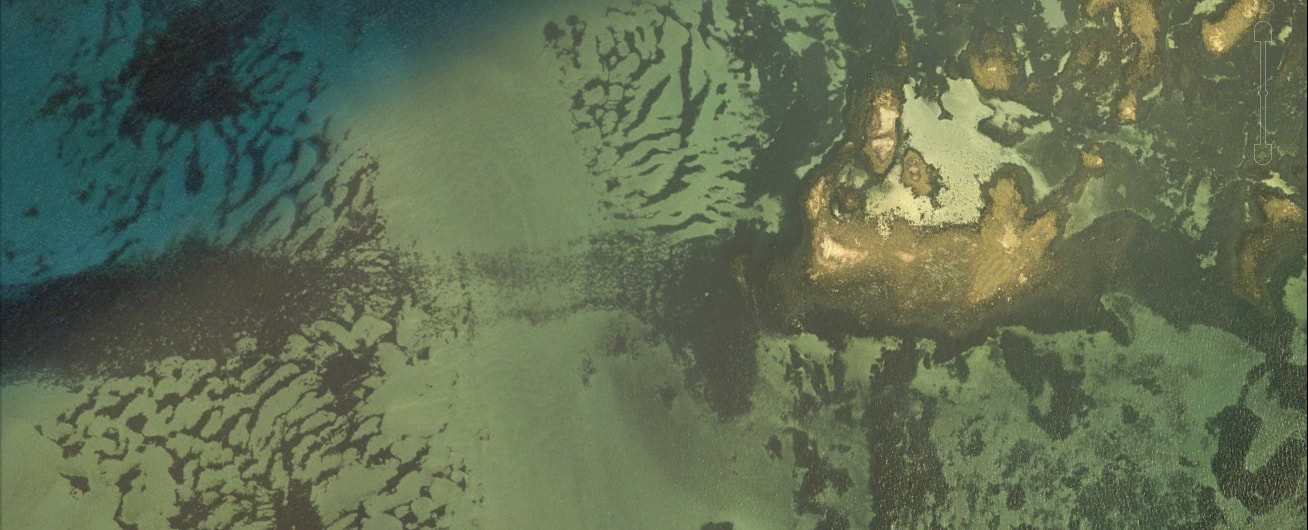
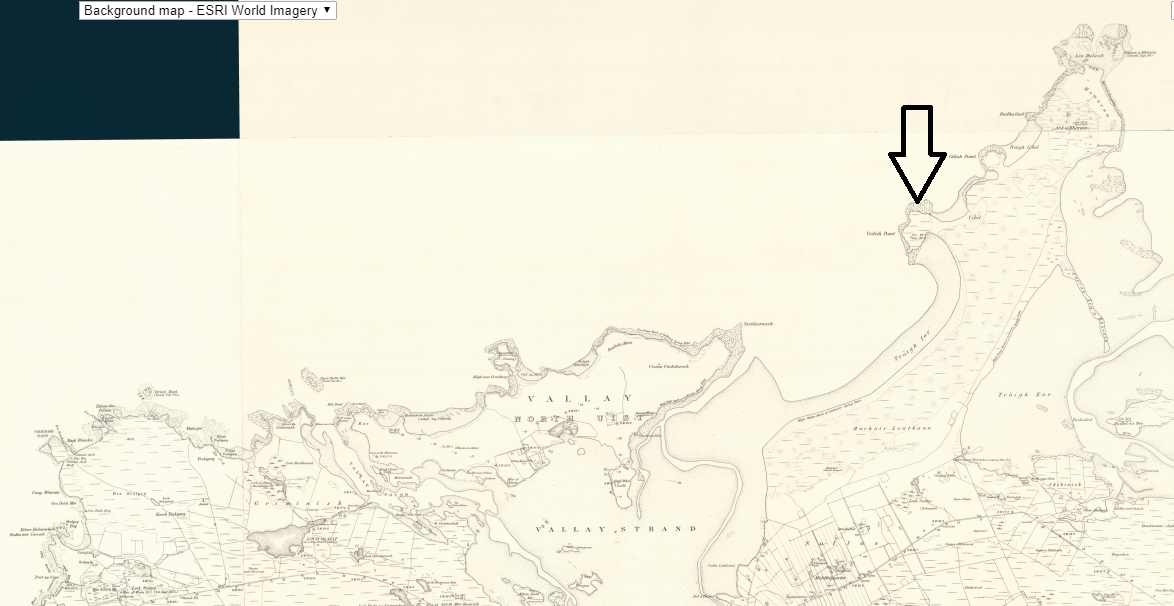
This leaves Watna. As Beveridge states ON vatn = lake is a good start and is a very common component of Norse place names. The genitive plural is ON vatna = of the lakes, descriptive of an area with a lot of lochs, whilst an alternative is ON vatn + a = river of the lake. This would work well for Loch Hosta and the stream running to the sea, an important enough feature for Blaeu to mark it on his map.
This also works as an area in the appropriate place on Uist relative to the above list and so Watna would represent Hosta, Balmartin and Balelone, These three combined have an area of arable land of around 300 hectares, which using our usual estimate of around 20 ha per pennyland would be large enough to be worth 14d.
There is a view amongst some academics that each terung of land (an area of arable land that we believe to be of the order of 400 ha in the Uist and more details are contained in my Unganab post) had a chapel within its bounds, indeed some think that each half terung contained a chapel.. There is no evidence for a chapel at Griminsh or Scolpaig and so the chapel in ”Le Terung de Watna, Scolping et Gremynis” would have to be in the Watna section. There are two contendors in the Hosta. Balmartin and Balelone area, one being Cille Pheadair and the other St. Clemenet's Chapel, although the later might just fall outside the bounds of Hosta.
One possible explanation for the similarity in names could be that the whole area started as Watna and then over the years, the area was divided but the name remained for one section of the original area and evolved to become Vannt, i.e. the names are the same but represent a different area.
There was a further place-name left in the memory that Beveridge talks about. He writes “Local tradition gives Mant (otherwise am Fearann Mantach [Estate or farm of the Mantach] or An sgire Mhantach [District or parish of the Mantach]) as the ancient name of a district near the western shore of North Uist, and representing part as least of the tract which lies between Balranald and Scolpaig.”
The suffix ScG -ach is used to eman 'place of' in Gaelic and so here we have Mantach = 'place of 'Mant''
Mhant would be the genitive case and so mean of Mant and as in ScG mh would be pronounced as v giving vant. This is where I imagine Vannt has come from. With the previous Watna, it is worth observing that in Danish ON vatn became 'vand'. In Gaelic this 'd' would sound as a 't' and so here we see that the metathesis (letter swapping) of the 'n' and of the 't' is not only feasible but hapened in the language shift from Norse to Danish.
Overall then, one can see the name-place chronology as follows. The Norse used the name Vatna for the area between Hosta, Balmartin and Balelone. After the Norse left, under a process of Gaelicisation, by 1505 this became Watna and from there became Mhant. Balmartin appears separately in this 1505 rental out of order and possibly reflecting its ownership by the church.
The area that Mhant referred to then steadily shrank until by 1718 is was called the pheonetically identical Vannt and was just referring to the central area of Balmartin, a name that reassertied itself by 1764.
If the name can be used for a smaller area, then going backwards in time, I do wonder if in fact Vatna actually included Scolpaig and Griminis before the estate was subduvuded - it is odd otherwise to refer to the three estates as one 'terung'.
P{S On further reflection, I suspect that Hosta was part of the original Holf settlement.
Vannt/Watna
Watna 1505 RMS: ”Le Terung de Watna, Scolping et Gremynis”
Vannt 1718 Rental: between Trumiskarry and Hosta
Beveridge writes “it would almost seem that Vannt ought to be treated as a variation of the place-name Watna” and Crawford follows this principle.
In the 1505 rental, the order makes sense, following around the coast in a clockwise sense reading Bailrannald, Holf, “Watna, Scoping et Gremynis”, Wala then Solos. As Wala (Vallay) and Solos (Sollas) are included in the same charter then they are different places.
You would expect Watna as the first named to be logically geographically before Scolping then Gremynis in the clockwise round of North Uist
Beveridge argues that with Scolpaig as a 2d land and Griminish as a 4d land then Watna must be worth 14d to make up the terung and so is of quite a large extent, probably around 280ha of arable land.
Beveridge argues that Holf is Hougarry which leaves Watna to include some or all of Tigharry, Hosta, Balmartin and Balelone. However if Vannt is identified with Watna then in the 1718 rental, Hosta, Balloan, Tigheary, Kilpheder, Ballekinloch are all tenanted and so the only area left for Watna must be Balmartin. The problem is that Balmartin appears as Talmertane in the same 1505 charter as Watna with a 2d valuation providing a quandry, both in terms of size and of replication..
The only sensible conclusion is that Vannt and Watna are not the same place, contrary to the thoughts of Beveridge and Crawford.
Vannt must be an old name for Balmartin and there is some evidence for this discussed later.
This leaves Watna. As Beveridge states ON vatn = lake is a good start and is a very common component of Norse place names. The genitive plural is ON vatna = of the lakes, descriptive of an area with a lot of lochs, whilst an alternative is ON vatn + a = river of the lake. This would work well for Loch Hosta and the stream running to the sea, an important enough feature for Blaeu to mark it on his map.
This also works as an area in the appropriate place on Uist relative to the above list and so Watna would represent Hosta, Balmartin and Balelone, These three combined have an area of arable land of around 300 hectares, which using our usual estimate of around 20 ha per pennyland would be large enough to be worth 14d.
There is a view amongst some academics that each terung of land (an area of arable land that we believe to be of the order of 400 ha in the Uist and more details are contained in my Unganab post) had a chapel within its bounds, indeed some think that each half terung contained a chapel.. There is no evidence for a chapel at Griminsh or Scolpaig and so the chapel in ”Le Terung de Watna, Scolping et Gremynis” would have to be in the Watna section. There are two contendors in the Hosta. Balmartin and Balelone area, one being Cille Pheadair and the other St. Clemenet's Chapel, although the later might just fall outside the bounds of Hosta.
One possible explanation for the similarity in names could be that the whole area started as Watna and then over the years, the area was divided but the name remained for one section of the original area and evolved to become Vannt, i.e. the names are the same but represent a different area.
There was a further place-name left in the memory that Beveridge talks about. He writes “Local tradition gives Mant (otherwise am Fearann Mantach [Estate or farm of the Mantach] or An sgire Mhantach [District or parish of the Mantach]) as the ancient name of a district near the western shore of North Uist, and representing part as least of the tract which lies between Balranald and Scolpaig.”
The suffix ScG -ach is used to eman 'place of' in Gaelic and so here we have Mantach = 'place of 'Mant''
Mhant would be the genitive case and so mean of Mant and as in ScG mh would be pronounced as v giving vant. This is where I imagine Vannt has come from. With the previous Watna, it is worth observing that in Danish ON vatn became 'vand'. In Gaelic this 'd' would sound as a 't' and so here we see that the metathesis (letter swapping) of the 'n' and of the 't' is not only feasible but hapened in the language shift from Norse to Danish.
Overall then, one can see the name-place chronology as follows. The Norse used the name Vatna for the area between Hosta, Balmartin and Balelone. After the Norse left, under a process of Gaelicisation, by 1505 this became Watna and from there became Mhant. Balmartin appears separately in this 1505 rental out of order and possibly reflecting its ownership by the church.
The area that Mhant referred to then steadily shrank until by 1718 is was called the pheonetically identical Vannt and was just referring to the central area of Balmartin, a name that reassertied itself by 1764.
If the name can be used for a smaller area, then going backwards in time, I do wonder if in fact Vatna actually included Scolpaig and Griminis before the estate was subduvuded - it is odd otherwise to refer to the three estates as one 'terung'.
P{S On further reflection, I suspect that Hosta was part of the original Holf settlement.


 RSS Feed
