Back in November 2019 I put up a post about Dun an Sticer and where the name might have come from. The more one investigates place names, the more one realises how little one knows. I am now writing another post about the name with a few new ideas and rethinking some of the others.
Unusually we do have an early form for the name courtesy of Timothy Pont whose work was eventually published by Blaeu in 1654, the surveying having been done c1600. The problem is that this name is significantly different to the modern one. Even the Blaeu name has a problem - it appeared on two adjacent maps in the Blaeu Atlas and a scribal error led to two names appearing: Dunamich and Dunainich. Confusing an /m/ with an /in/ is easy to do but the first is the one that appeared on the Uist map, the second as the extract on the Harris and Lewis map so logic would say that Dunamich was the ‘proper’ name and Dunainich the one with the scribal error.
Unusually we do have an early form for the name courtesy of Timothy Pont whose work was eventually published by Blaeu in 1654, the surveying having been done c1600. The problem is that this name is significantly different to the modern one. Even the Blaeu name has a problem - it appeared on two adjacent maps in the Blaeu Atlas and a scribal error led to two names appearing: Dunamich and Dunainich. Confusing an /m/ with an /in/ is easy to do but the first is the one that appeared on the Uist map, the second as the extract on the Harris and Lewis map so logic would say that Dunamich was the ‘proper’ name and Dunainich the one with the scribal error.
ON vík is a common component of names in the Norse world, usually appearing as Uig in the Hebrides if a simplex name. ON víki occurs three times as a name in Iceland.
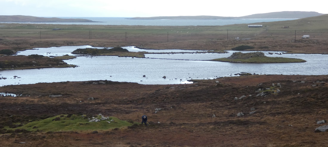
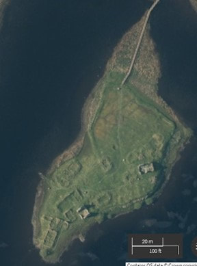
Topographically the nearby bay at Port nan Long is a good fit but intriguingly the presence of Dùn an Sticer is intriguing as the putatively named stronghold, possibly implying that the Norse used it themselves as such. It has certainly been used after the Iron Age when it was constructed.
One might also have expected the name ON vík to have been attached to a feature closer to the bay itself although it is not impossible to be attached to the dùn. Without any more evidence, we won’t know.
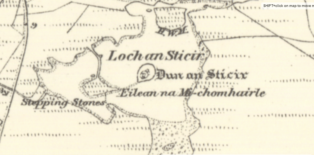
As for the second name Dùn an Sticer, there are two points of interest. One is that the loch is called Loch an Sticir and the dùn is called Dùn an Sticer. The second is the late addition in the OS name book of the article ScG an in the name of the dùn.
Topographically the nearby bay at Port nan Long is a good fit but intriguingly the presence of Dùn an Sticer is intriguing as the putatively named stronghold, possibly implying that the Norse used it themselves as such. It has certainly been used after the Iron Age when it was constructed.
One might also have expected the name ON vík to have been attached to a feature closer to the bay itself although it is not impossible to be attached to the dùn. Without any more evidence, we won’t know.
As for the second name Dùn an Sticer, there are two points of interest. One is that the loch is called Loch an Sticir and the dùn is called Dùn an Sticer. The second is the late addition in the OS name book of the article ScG an in the name of the dùn.
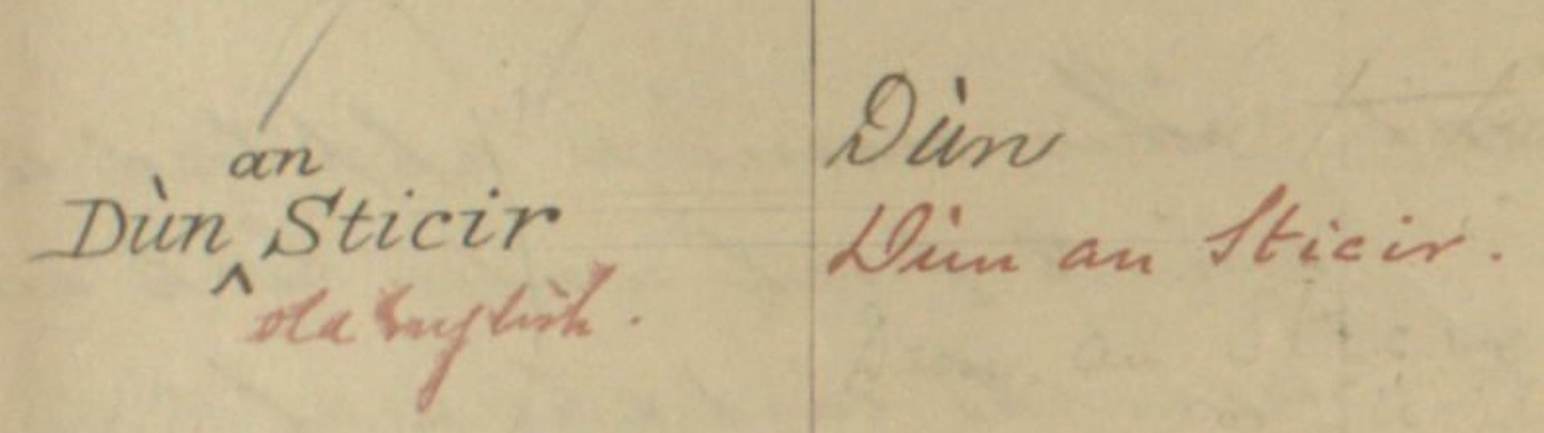
One might have expected the loch to be called Loch Dùin an Sticer if it was just the dùn that was attached to the component /sticer/. The lack on the article ScG an also points to the /sticir/ being a separate onomastic unit, probalby created by Carmichael 'correcting' the Gaelic as hje often does in his red ink.
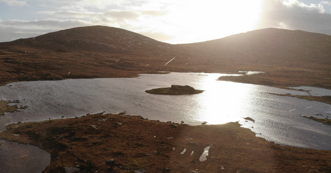
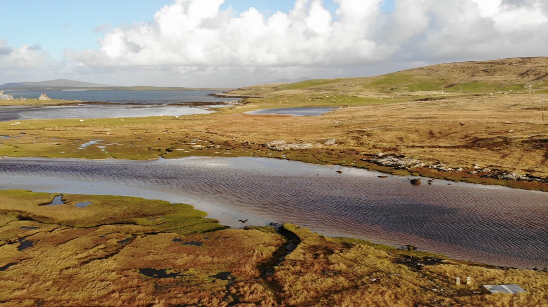
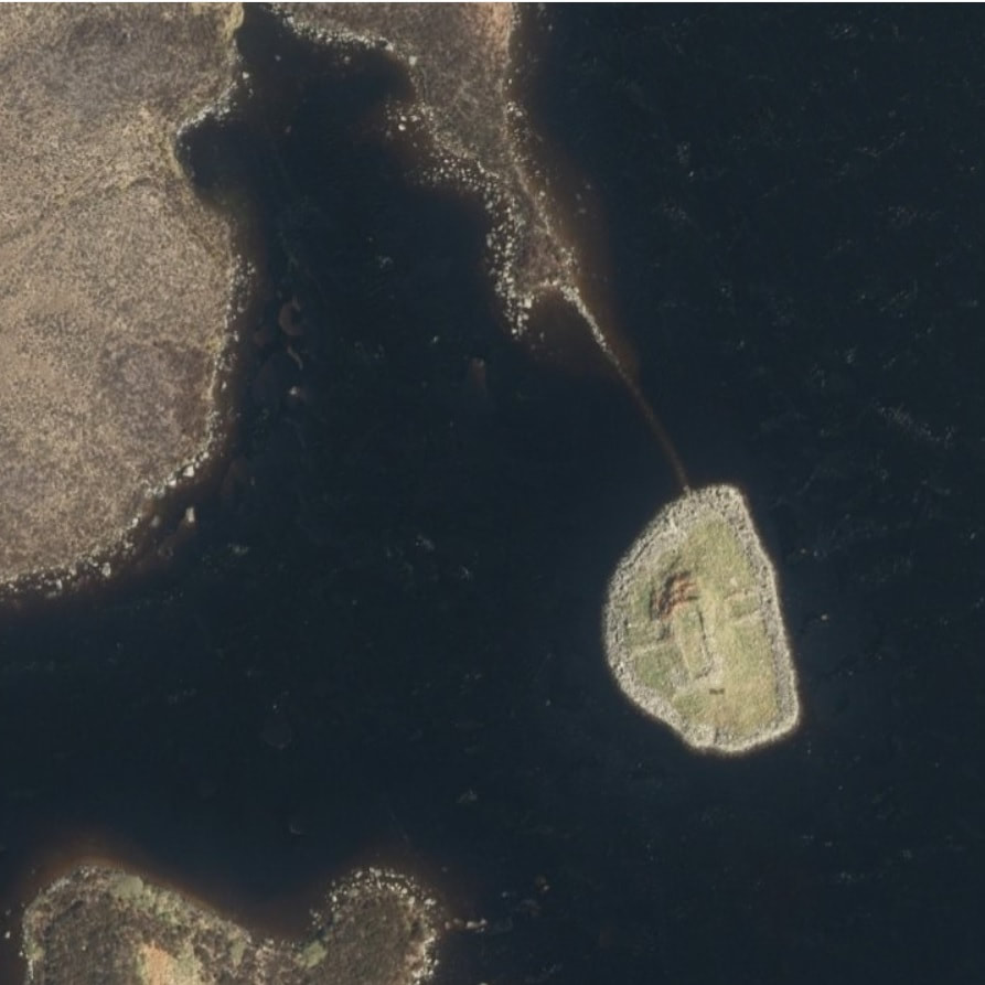
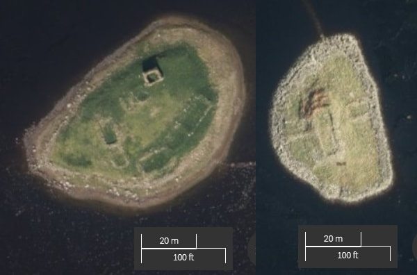
The evidence then is that there was a place here called /sticir/. I had thought of ON stigr = ‘path’ but the word tends to apply to steep difficult path, a situation that doesn’t really exist here. I suggest that an alternative is ON sík á = ‘ditch river’ which Rygh equates with a slow-running river. This would describe perfectly the river that flows from the loch to the sea as can be seen in the image below.. The long /a/ would sound close to /ar/ and the Gaels would slenderize the /s/ here creating a /sh/ sound: ON sík á > ScG shikar. The /t/ is not there but there is a keenness to resemanticise to a form of the verb ScG stìog = ‘to skulk’.
Why? There is a traditional local story related by Beveridge, ‘Hugh, son of Archibald the Clerk, laid claim to some portion of North Uist, and accompanied by his step-mother, took refuge in Dun an Sticir with the purpose of there fortifying himself against his relative – evidently a second cousin -Donald Gorm Mor (then chief of Clan Huistein) who sent a strong party to apprehend the usurper. Hugh, seeing that it was hopeless to resist a siege, swam from the fort to a neighbouring islet, and might have escaped had he not been betrayed by his step-mother.’ He was taken to Duntulm Castle and it is said fed a diet of nothing but salt beef until he died of thirst. A pleasant saga.
However the word ‘skulker’ would then fit this story well as Hugh skulked in the dùn. So going from /shikar/ to /sticir/ makes some sense as the name is now justified by the story.
Interestingly this story happened in the 1590s, just when Pont was doing his survey work and so the ‘new’ name would not have taken hold yet. As ever without more early forms we will not realy know - it has the advantage of offering more interestin options!
With thanks as ever to the National Library of Scotland for their fantastic map resources.


 RSS Feed
